Field Services Team Monitoring System
An Excel-based geolocalization system that tracks field agent activities, calculates distances, and measures productivity through interactive maps with color-coded performance indicators.
📋 Project Overview
Managing a distributed field services team with 500+ agents requires real-time visibility into their activities, locations, and performance. This system was designed to give operations managers instant insights into field activities, ensuring visits are conducted properly and productivity is measured both numerically and visually.
Built entirely in Excel with VBA automation, the system generates individual HTML maps for each agent, showing color-coded pins that represent different types of management activities.
🎯 The Challenge
- No visibility into field agent locations and activities
- Manual tracking was time-consuming and error-prone
- Difficult to verify if visits were actually conducted
- No way to measure productivity geographically
- Needed a solution accessible to non-technical managers
💡 The Solution
- Automated geolocalization using GPS coordinates
- Distance calculation to verify visit authenticity
- Visual maps with color-coded performance indicators
- Excel-based for maximum accessibility
- Individual agent reports with drill-down capability
🎨 Map Pin Legend
Each pin color represents a different type of activity or status:
⚙️ System Process Flow
📸 System Visualization
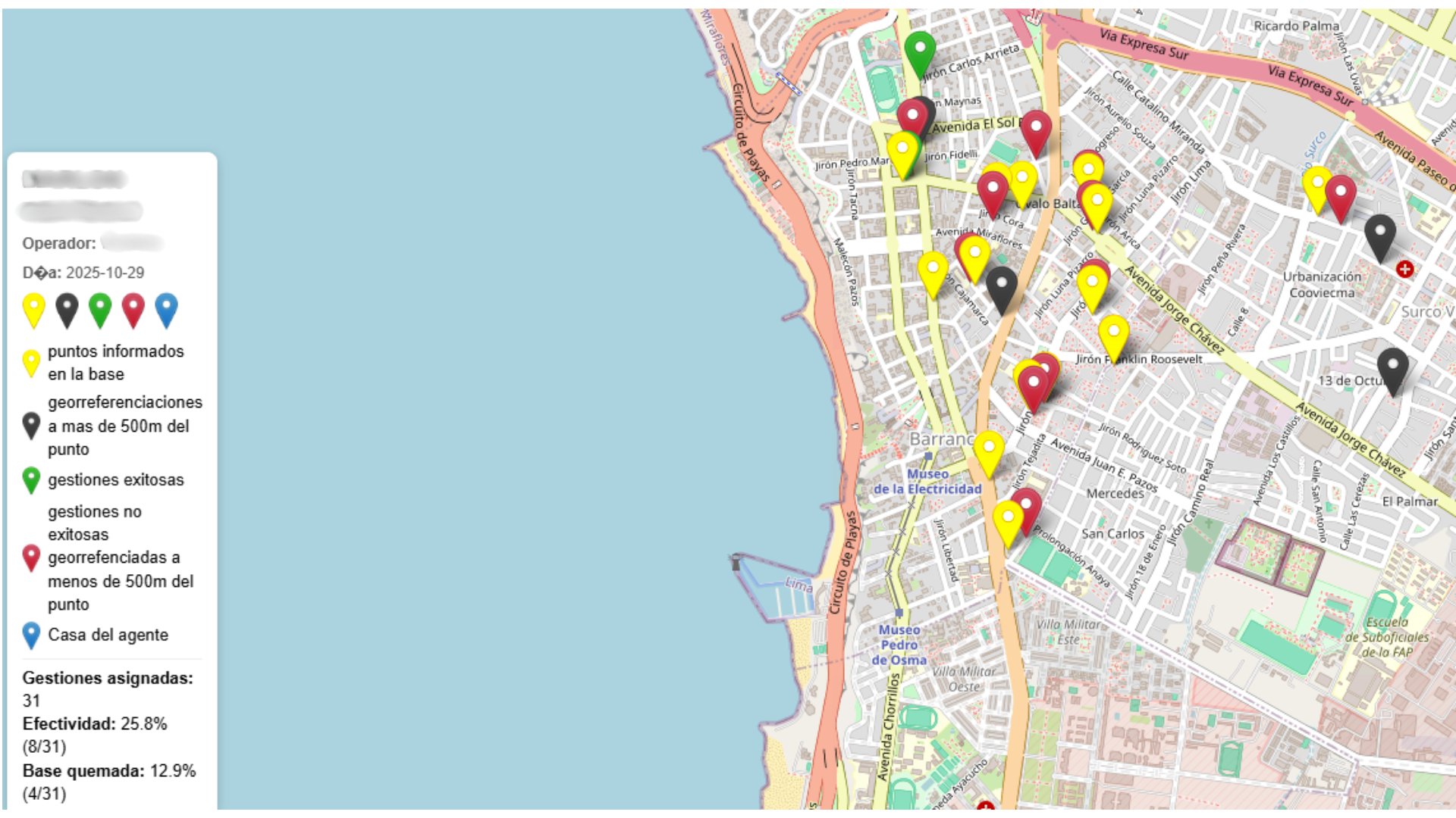
Agent Activity Map
Real map showing color-coded performance indicators for field agents in Lima, Peru.
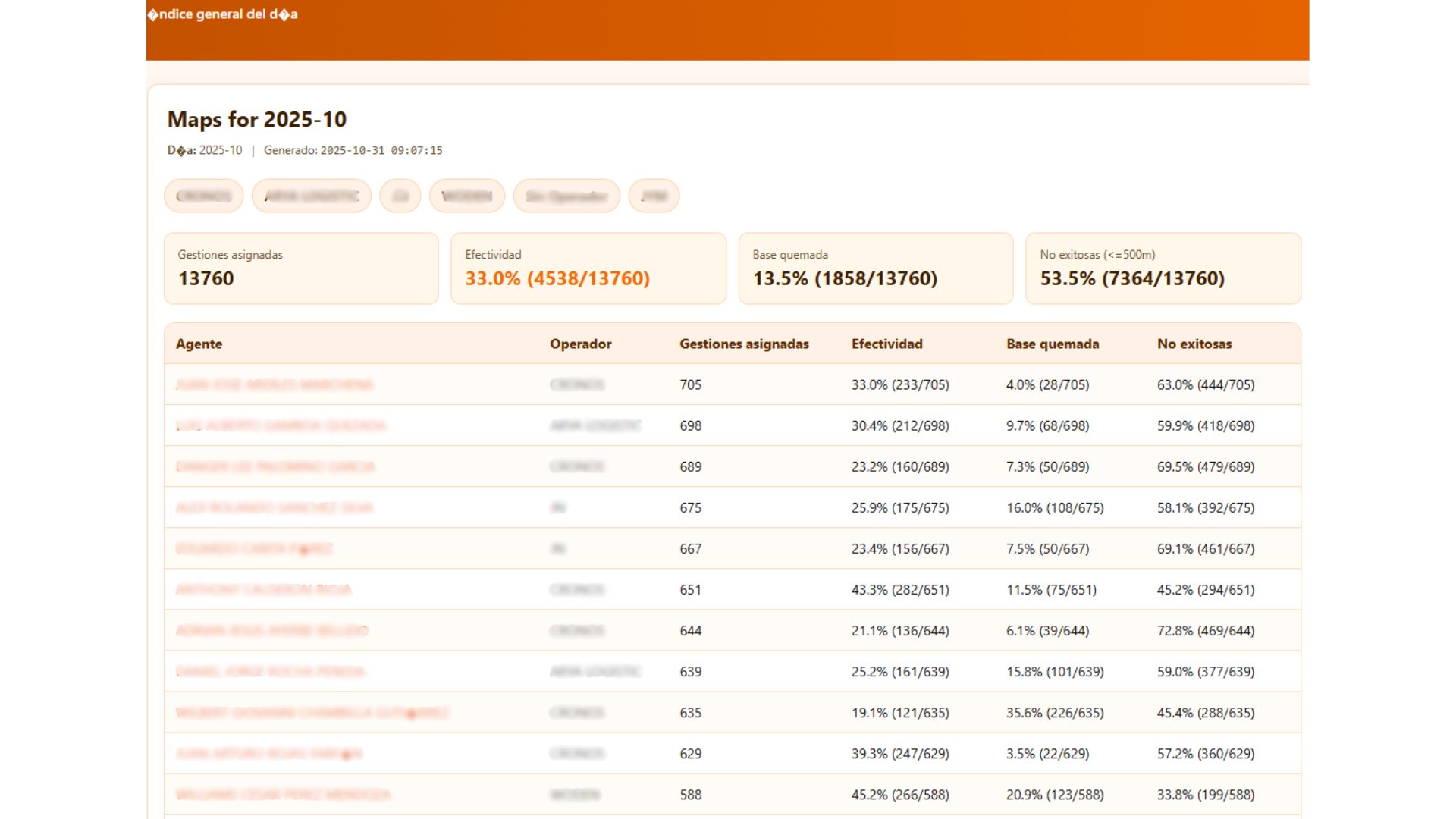
Performance Dashboard
Real-time KPIs showing team performance, effectiveness rates, and compliance metrics.
🎬 System Demo Video
Watch how the monitoring system works in action:
📈 Results & Impact
🛠️ Technology Stack
Powerful solutions built with accessible tools for easy maintenance.
Need a Similar Solution?
I can help you design and implement monitoring systems that give you real-time visibility into your field operations.
📞 Let's Discuss